Some of our recently published work (Toma-Danila et al., 2022) regarding the Network-risk methodology and toolbox applied to Bucharest has been included in a new app: “The seismic risk of Bucharest”.
Check it out at https://tinyurl.com/yt32aeyx. Although in Romanian, it shouldn’t be hard to understand.
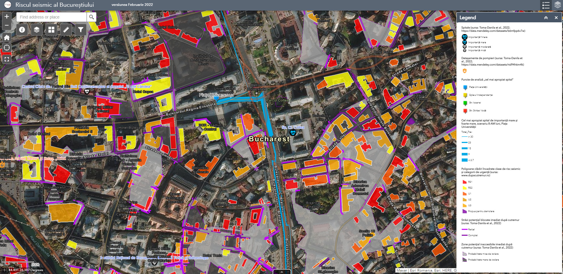
The app includes layers regarding:
- individual buildings in seismic risk class I and II or urgency categories (all highly vulnerable buildings – but not all of them in reality)
- buildings affected by the 1977, March 4 (Mw 7.7; 94 km depth) and the 1940, November 10 (Mw 7.7; 150 km depth) Vrancea earthquakes
- areas which might become inaccesible in case of an earthquake (based on Toma-Danila et al., 2022)
- service area results for the nearest hospital and fire department (based on Toma-Danila et al., 2022)
- routes toward important hospitals, for 4 representative analysis points in the city centre (based on Toma-Danila et al., 2022)
- results of the hazard and risk analysis (for the 1:1000 years return period) performed by INCDFP, URBAN-INCERC and UTCB within the Ro-Risk Project in 2017
- hospitals in Bucharest and Ilfov County, with info regarding their importance in case on an earthquake (based on Toma-Danila et al., 2022)
- fire stations in Bucharest and Ilfov County (based on Toma-Danila et al., 2022)
- seismic zonation maps, according to the present seismic design code (P100-1/2013)